In an era of continuous urban expansion and evolution, urban spatial science is gradually becoming key to solving complex urban problems. University College London (UCL)'s MSc Urban Spatial Science program, with its unique positioning and abundant resources, attracts many students with dreams of transforming cities. Below we will comprehensively analyze this program from aspects such as program overview, curriculum, admissions requirements, and career prospects. For more details and graduate application inquiries, scan the QR code below for a one-on-one consultation.

Program Overview
As a world-class institution, University College London has always been at the forefront of academic research and educational innovation. Its MSc Urban Spatial Science program is dedicated to cultivating professionals who can use advanced technologies and theories to deeply understand and improve urban spaces.
The program integrates knowledge from multiple disciplines, including geography, computer science, engineering, sociology, etc., creating a unique interdisciplinary research environment. Students here can break traditional disciplinary boundaries, examine urban spatial issues from multiple perspectives, and develop comprehensive analytical and problem-solving skills.
London, as a global hub for finance, culture, and technology, provides a natural laboratory for the program. Students have the opportunity to engage with various types of urban spatial cases, from the renewal of historic districts to the planning of modern commercial areas. The university also has close partnerships with many local government departments, enterprises, and research institutions in London, allowing students to participate in real projects, gain first-hand practical experience, and stay updated on the latest industry trends and demands.
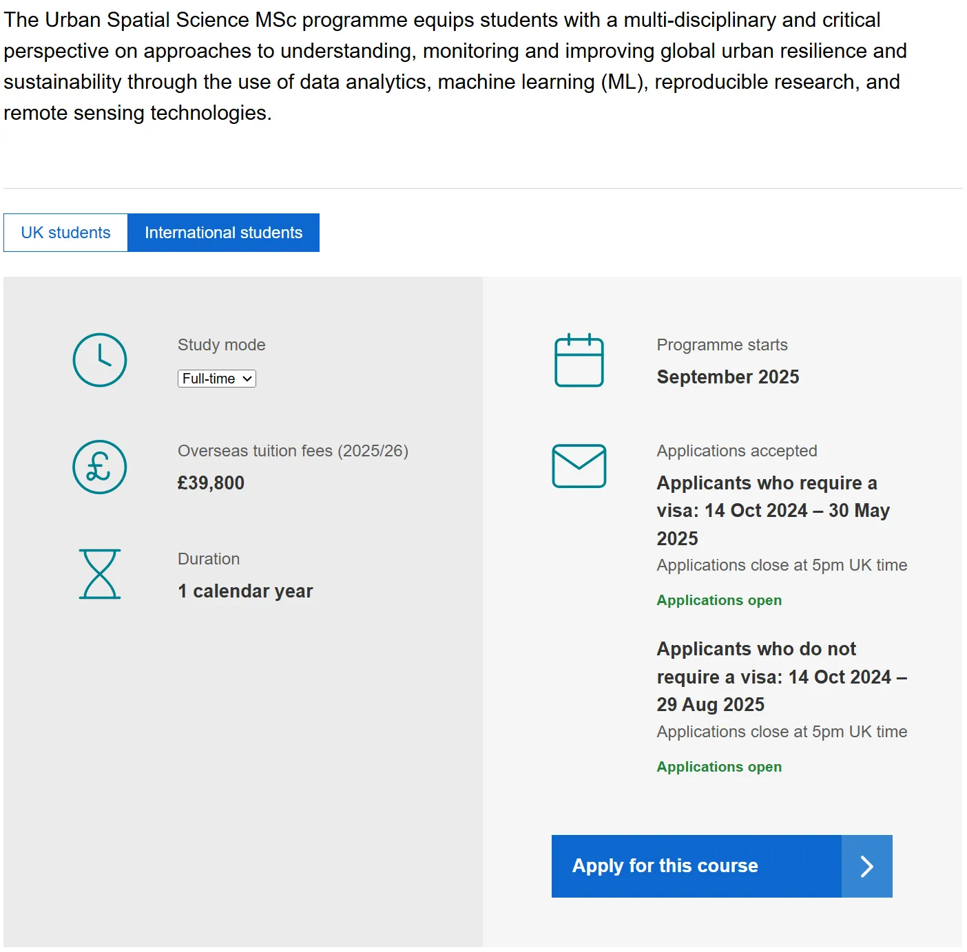
Official website: https://www.ucl.ac.uk/prospective-students/graduate/taught-degrees/urban...
Curriculum
Core Courses
- Urban Analysis Foundations: This course lays the theoretical and methodological foundation for urban spatial analysis. Students will learn how to collect, organize, and analyze urban spatial data, including population distribution, land use, traffic flow, etc., master basic data analysis tools and techniques such as Geographic Information Systems (GIS) and remote sensing, thereby understanding the structure and dynamics of urban spaces.
- Spatial Data Analysis and Visualization: This course focuses on developing students' ability to process and present spatial data. Students will delve into advanced data analysis methods such as spatial statistical analysis and the application of machine learning algorithms in spatial data, and learn to use professional software to transform complex data into intuitive visual charts and maps, better presenting urban spatial features and patterns to support decision-making.
- Urban Spatial Modeling: This course teaches the principles and methods of constructing urban spatial models. By building mathematical models to simulate phenomena in urban development such as urban growth, traffic flow prediction, and land use change, it helps students predict future urban trends, evaluate the impact of policies and plans on urban spaces, and provide a scientific basis for urban planning and management.
Elective Courses
- Smart City Technologies: This course focuses on the application of emerging technologies in urban spaces, such as the Internet of Things, big data, and artificial intelligence. Students will learn how these technologies change urban operations and enable intelligent management, with cases and trends in areas like smart transportation, smart energy management, and smart security.
- Spatial Science in Urban Design and Planning: This course explores the specific application of spatial science in urban design and planning practice. Students will learn how to use spatial analysis results to guide urban planning schemes, optimize functional layouts, public space design, and transportation network planning, enhancing the livability and sustainability of cities.
Practical and Research Components
Practical courses are a key component of the program. Students typically participate in real urban spatial research projects, working with local partners in London. In these projects, students apply their knowledge and skills to solve actual urban spatial problems, developing teamwork and project management abilities.
The dissertation requires students to conduct in-depth research on a specific topic in urban spatial science. Students must independently design a research plan, collect and analyze data, and write a research report, demonstrating their mastery of professional knowledge and independent research skills.
Admissions Requirements
Academic Background
Applicants should hold a bachelor's degree. Relevant disciplinary backgrounds include but are not limited to geography, computer science, mathematics, statistics, engineering, and urban planning. The university places greater emphasis on solid quantitative skills and an interest in urban spatial science. A certain level of undergraduate grades is generally required: for UK bachelor's degree holders, typically a 2:1 or above; for Chinese students from well-known universities, a weighted average score of 85 or above is recommended (specific requirements may vary by institution and background).
Language Requirements
- IELTS: Overall score of 7.0, with no subscore below 6.5.
- TOEFL: Overall score of 100, with reading and writing at least 24, and speaking and listening at least 20.
Personal Statement
The personal statement should clearly explain the applicant's interest in urban spatial science, relevant experiences (such as course projects, internships, research), and reasons for choosing the program. It should also articulate career goals and what they hope to achieve through the program, with a recommended length of 500-1,000 words.
Recommendation Letters
Two recommendation letters are usually required, ideally from university professors or mentors who can attest to the applicant's academic ability and research potential. The letters should detail the applicant's academic performance, professional skills, research enthusiasm, and potential in urban spatial science.
Resume
The resume should concisely list the applicant's educational background, work experience (if any), academic achievements (such as publications and research projects), internships, awards, and honors, highlighting experiences and skills relevant to urban spatial science.

Career Prospects
Career Directions
- Urban Planning and Design Firms: Graduates can work as urban analysts or planning assistants, using spatial science technologies to provide data support and analysis reports for urban planning projects. For example, by analyzing population density and traffic data, they advise on site selection and functional layouts for new districts; using spatial modeling to assess the impact of planning schemes on urban environments and residents' lives.
- Government Departments: Work in local government departments such as urban planning, traffic management, and environmental monitoring. Responsibilities include collecting and analyzing urban spatial data, formulating policies and plans—for instance, participating in traffic congestion management by using spatial data to identify congestion hotspots and propose improvements; in environmental monitoring, using remote sensing and GIS to track urban ecological changes and inform environmental protection policies.
- Technology Companies: With the rise of smart cities, many tech companies are entering the urban spatial field. Graduates can engage in urban data mining, algorithm development, and product design. For example, developing big data-based traffic flow prediction systems for smart traffic management; or designing spatial data analysis platforms for city managers to improve efficiency and decision-making.
- Research Institutions: Pursue academic research, delving into cutting-edge issues in urban spatial science. Graduates can work as researchers or assistant researchers in universities or research institutes, participating in projects, publishing papers, and advancing the theory and technology of urban spatial science.
Career Advantages
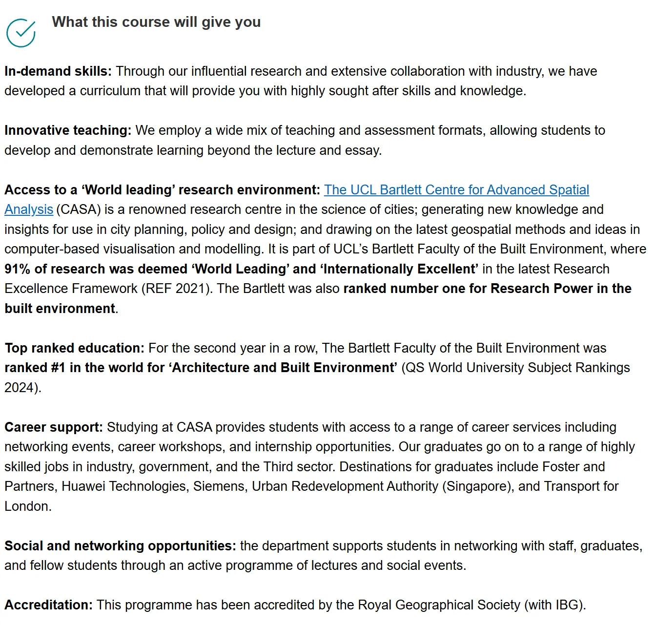
The international reputation of University College London and the program's professionalism give graduates strong competitive edge. Through the program, students master advanced urban spatial analysis techniques and an interdisciplinary knowledge base, meeting the demand for urban spatial science professionals across various industries. The university's extensive industry collaboration and alumni network also provide broad employment channels and career support. Moreover, the program's emphasis on practical skills means students accumulate real project experience, enabling them to quickly adapt and add value in the workplace.
In summary, UCL's MSc Urban Spatial Science program provides a platform for comprehensive and in-depth study of urban spatial science, with broad prospects and endless possibilities for both academic research and career development.
For more admission case studies and graduate application questions, add the CheersYou(清柚教育) consultant's contact information below for more details.